Visit Worldwide Topsites
Showing posts sorted by date for query Nonius. Sort by relevance Show all posts

Monday, 18 February 2013

Deslandres and the surrounding craters. Astronomical telescope images


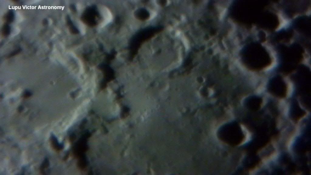
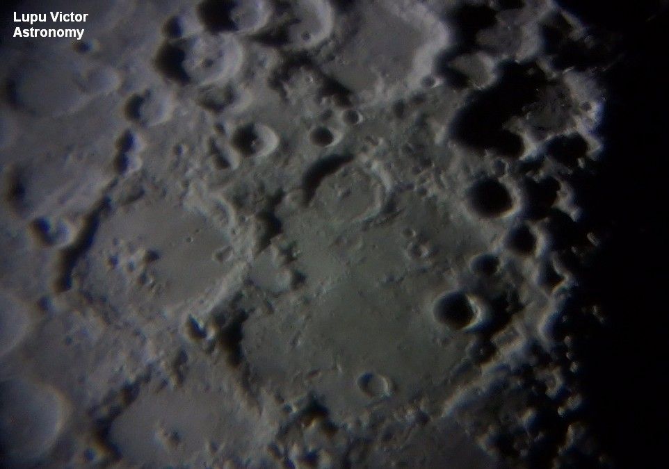
These images are very clear, as the camera focus was best. In the pictures here, we have the huge crater Deslandres (234 km) north of the bright crater Tycho.  To view the telescope video of these photos, go here.

A very bright rays of Tycho with high albedo, are spread on the whole region, but these are not seen in the photos because of the Moon phase at that time, when the Sun was at a low angle.

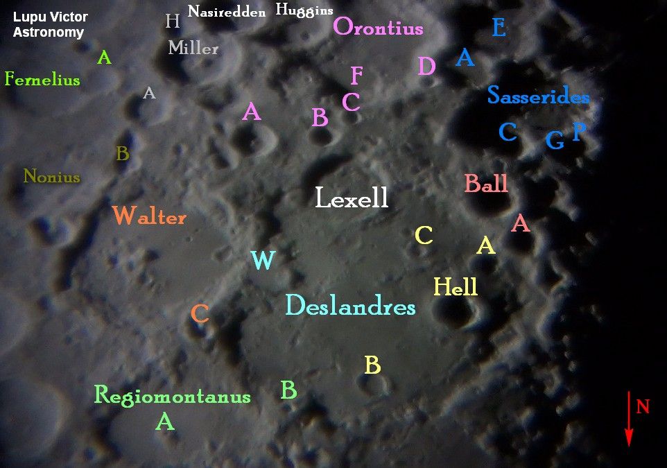
The picture below explains in great detail all craters located inside of Deslandres, and neighbors, as I labeled them each name with color. Images are inverted as seen through the telescope.

As you can see, this area is very rich in craters of all sizes, feature which is common to the south of the Moon. In these pictures, are craters like: Lexell, Sasserides, Walther, Orontius, Hell, Nonius and others.

Info Deslandres crater.
Coordinates32.5°S 5.2°
Diameter256 km
DepthUnknown
Colongitude5° at sunrise
EponymHenri A. Deslandres


Moon age: 7 days
Stage: 51% (0% = New, 100% = Full)
Distance: 384.488 km

Optics: Celestron C8-Newtonian telescope, 20mm Plössl, 2x barlow
Mount: CG5 (EQ5)
Camera: Sony CX130
Filter: no
Date: 29/04/2012
Location: Baia Mare, Romania
Processing: video captures, FastStone Image Viewer

Thursday, 26 July 2012

HD telescope video with heart-shaped Deslandres crater on the Moon.

The video images of this article are upside down (north and south are reversed), as seen through the telescope. Images were stabilized in Sony Vegas 10, because the mount wasn't motorized. The quality of our atmosphere was very good and that is why the lunar surface details are clear.

 Deslandres (234 km), is a desintegrated crater of pre-Nectarian era, and is one of the largest craters on the Moon. I like to think it has a heart shape. Also note in the video below, the eroded crater Lexell (63 km) on its southeastern edge and Hell (33 km), a smaller crater, named for astronomer Maximilian Hell, on the west. Hell Crater, shows a central peak in the center, but not visible due to the shadow that covers the crater floor. You may also notice a line of small craters on the eastern crater floor of Deslandres.


Video: Victor Lupu
Optics: CelestronC8 "-Newtonian telescope, plossl20mm, 2x Barlow
Mount: CG5 (EQ5)
Device: Sony CX-130
Video mode: Full HD progressive 1920x1080
Filter: no
Date: 29/04/2012
Location: Baia Mare, Romania
Processing and editing: Sony Vegas 10


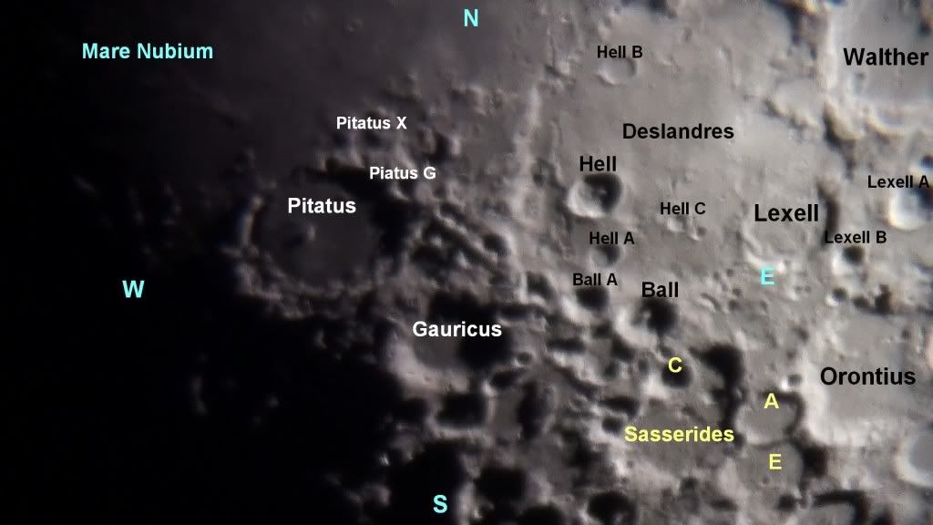
Other large craters in this video, can be identified in the photo below, as Walther, Regiomontanus, Nonius, Sasserides and Orontius.

                                    The picture below was made on May 11, 2011.

Tuesday, 27 December 2011

List of south features of the Moon-Southern lunar Hemisphere


Southern hemisphere of the Moon is in rough terrain, heavily cratered and with mountainous areas.
At the poles, the sun is always at small angles, so this is creating a unique environment, but also some difficulties in interpreting the geological region.
The southern hemisphere of the Moon craters are very different in size, appearance and how they were formed by impacts in the past.
Personally, the most interesting craters on south, I find Tycho, a crater with rays showing a very high albedo, rays that are left behind from the initial impact, wich can be seen from Earth with the naked eye or binoculars.
Another great crater is Clavius​​, a large crater with other small craters lying inside it in a decreasing order to form a spiral.
Shiller is another crater, interesting to me because of its elongated shape similar to a caterpillar.
 On the southern hemisphere of the Moon seen from Earth, there is only a sea, Mare Nubium that penetrate down to the crater Pitatus.

There are not mountains on the Moon's southern hemisphere. Maybe were probably destroyed by countless impacts were.

Most notable craters of the Moon southern hemisphere, in alphabetical order, are:

Aliacensis
Apianus
Asclepi
Baco
Ball

Barocius
Biela
Blanchinus
Boguslawsky
Bosching
Boussingault
Brown
Buch
Casatus
Cichus
Clairaut
Clavius
Curtius
Cuvier
Cysatus
Deluc
Demonax
Deslandres
Fabricius
Faraday
Fernelius
Frisius
Gauricus
Gemma
Gruemberger
Hagecius
Heinsius
Hell
Helmholtz
Heraclitus
Hommel
Jacobi
Janssen
Kaiser
Kinau
Klaproth
Lexell
Licetus
Lilius
Longomontanus
Maginus
Manzinus
Maurolycus
Metius
Miller
Montanari
Moretus
Mutus
Neander
Nearch
Neumayer
Newton
Nonius
Orontius
Pentland
Picret
Pitatus
Pitiscus
Playfair
Poisson
Pontanus
Pontecoulant
Proctor
Rabbi Levi
Rheita
Riccius
Rosenberger
Sasserides
Saussure
Sempilius
Short
Scheiner
Schiller
Schomberger
Scott
Steinheil
Stofler
Tannerus
Tycho
Vlaq
Watt
Weiss
Werner
Wilhelm
Wurzelbauer
Zach


Seas:
Mare Nubium

Space missions on the south side of the Moon:
Ranger 9 was launched on March 24, 1965 by United States of America and was intentionally crashed on the lunar surface, on crater Alphonsus.
Ranger 9 was designed to achieve an impact trajectory and to transmit pictures of the lunar surface in high-resolution during the flight until the impact.
  Ranger 9 successfully transmitted 5814 images with a resolution of up to 1.5 m.

LCROSS United States launched the LCROSS (Lunar Crater Observation and Sensing Satellite) which was deliberately crashed into the Moon's south pole on crater Cabeus on October 9, 2009
The mission was designed to search for water ice on the lunar surface and examining the resulting cloud, caused by impact. The mission ended with the discovery of significant amounts of water.

Moon Impact Probe was launched by India, and it was deliberately crashed on 14 November 2008 at the lunar south pole.
 It had 35 kg, and was released from Chandrayaan-1 Lunar Orbiter. It was equipped with a video camera, a radar altimeter and a mass spectrometer.


Video: Victor Lupu
Optics: CelestronC8 "-Newtonian telescope, plossl20mm, 2x Barlow
Mount: CG5 (EQ5)
Device: SonyCX105 at 7x optical zoom
Total Magnification: 700x
Filter: no
Date: 16/08/2011
Location: Baia Mare, Romania
Processing and editing: Sony Vegas 10


To see the photographic map of the south area of the Moon, view: Photographic map of the Moon: South Zone. Lunar Atlas.

For those who like my astro pictures or my articles, it woul be great if you could pay attention on advertising that appear in the blog by a click and maybe one day I could buy a better telescope.

Monday, 2 May 2011

Walther Purbach and Regiomontanus craters

Photographer: Victor Lupu
Optics: Celestron C8-Newtonian reflector telescope, plossl 20mm, 2x Barlow
Mount: CG5 (EQ5)
Device: Sony HDR CX105
Filter: No
Date: 14/11/2010
Location: Baia Mare, Romania
Processing: video capture


        Walther (128 km), is an old impact crater located in the southern region of the Moon. It is joined along the western edge with the crater Deslandres (234 km)., north-east of Aliacensis and south-eastern edge of Nonius (70 km), which is an irregular crater.
Walther's edge is complex, strongly eroded and incised by smaller impacts. Wall maintains a circular shape, in general, but many of its features are no longer visible.There is a prominent bump on the edge of west.The floor was renewed after the original impact . On the northeast in the crater is a central peak, which is affected by several small craters, including Walther A (12 km). Walther has cratered satellites called from A to X.
      Crater name comes from Bernhard Walther (1430 - Memmingen - June 19 1504 - Nuremberg), who was a German humanist and astronomer from Nuremberg, Germany.
He devoted himself to scientific concerns. When Regiomontanus settled in Nuremberg in 1471, they worked in collaboration to build an observatory and a printing press. After the death of Regiomontanus in 1476 in Rome, Walther bought his instruments and continued to observe planets until his death.

         Regiomontanus (126x110 km), is joined to the north edge of the crater Purbach (118 km) and on south-southeast is Walther.
The crater is eroded, and the edge is irregular, mountainous and oval. The walls on the south and west edges were almost completely degraded. A prominent ridge lies in the crater's north-west, together with Regiomontanus A (6 km), a small crater. Crater floor is flooded by lava, and has a small number of impact craters.
Regiomontanus A was once considered an evidence of volcanic activity on the Moon. However it is actually an impact crater.
      Regiomontanus has the name from Johannes Müller von Königsberg (June 6 1436-6 iul 1476), now best known by his latin toponym as Regiomontanus. He was a german mathematician, astronomer, astrologer and translator.

        Purbach (118 km), is a large lunar crater located in the rugged southern highlands of the Moon.It is attached to the southern edge with the distorted Regiomontanus crater. To the northwest is Thebit (57 km), and north-east lies La Caille (68 km).
    Purbach's outer wall is heavily hit, and most intact section being along the sides of the east and northeast. The wall where Purbach shares with Regiomontanus is incised rough. Along the western edge, gives the impression of a double edge. The north wall is almost completely destroyed and irregular.  Purbach G (27 km) is located on the northwestern edge of Purbach.
    The eastern half of the floor is good, with a reduced number of crests.
Other craters visible in these photos are Arzachel, Orontius A (7 km), Werner (70 km), Delaunay (47 km), Blanchinus (68 km) and La Caille (68 km).
        Delaunay (47 km). This is an irregular crater, which has an inner ridge from the north-east, dividing the crater almost in half, and gives a heart-shaped appearance. This ridge becomes increasingly thin as it approach the edge of the southwest, giving the appearance of a curved tooth. The outer edge of this crater is irregular and uneven walls vary in width.
      Crater name comes from Charles-Eugène Delaunay (April 9 1816 - August 5, 1872), which was a French astronomer and mathematician. His studies of movement of the Moon were important in promoting both the theory and the mathematics of planetary motion.

        Blanchinus (68 km). The outer edge of Blanchinus was significantly degraded by subsequent impacts, leaving it irregular in shape. The interior floor is almost flat with no significant impact.
     The name is given to Giovanni Bianchini (1410 - 1469), professor of mathematics and astronomy at the University of Ferrara and astrologer to Leonello d'Este.

        La Caille (68 km), is located northeast of the crater's Purbach.The floor of Caille was flooded in the past by lava, and the surface is smooth and relatively flat with no central peaks.Most notable crater is La Caille B (7 km), which lies on the eastern rim.
     Abbé Nicolas Louis de Lacaille (March 15 1713-21 mar 1762),a french astronomer, has the name of the crater.

 
All images are © Copyright 2010-2015 Lupu Victor. All rights reserved.Images may not be reproduced, published, or copied in any form without written permission of the author. Thank you for respecting the intellectual property rights. ASTROFOTOGRAFIA | Lupu Victor Astronomy - Contact - About
Design by Free WordPress Themes | Bloggerized by Lasantha - Premium Blogger Themes | Online Project management